127
127
Nov 12, 2012
11/12
by
KGO
tv
eye 127
favorite 0
quote 0
the sacramento-based company operates about 130raley superstores in california as well as nevada. better stock up on the twinkies. the hostess bakers are on strike. they are set up at a third of all hoss tess plants nationwide including the bakery in oakland. they say products are still being made and shipped, at least for now. hostess employs 1800 workers in california. they filed for bankruptcy in january. mother nature is providing a spectacular heavenly show for the next few days. the earth is passing through debris from comet enkey. thanks to this youtube video we can show you what they look like. they tend to be fireballs and you will get the best look at the meteors providing there isn't a lot of cloud cover leigh glaser is here to tell us about that. >> in the north bay you will not get a great view. we may seen see a few sprinkles. let's go outside and a few clouds are starting to move in. otherwise clear skies out there. live doppler 7hd picking up on some of the clouds. santa rosa and petaluma and heading toward vallejo and fairfield and american canyon and napa also re
the sacramento-based company operates about 130raley superstores in california as well as nevada. better stock up on the twinkies. the hostess bakers are on strike. they are set up at a third of all hoss tess plants nationwide including the bakery in oakland. they say products are still being made and shipped, at least for now. hostess employs 1800 workers in california. they filed for bankruptcy in january. mother nature is providing a spectacular heavenly show for the next few days. the earth...
176
176
Nov 20, 2012
11/12
by
KGO
tv
eye 176
favorite 0
quote 0
sierra nevada very high snow level with this. windy tuesday wednesday. mix of rain and snow both days. by thursday thanksgiving it's partly cloudy. so really it's looking like mixed precipitation high snow level for the tahoe area. tomorrow afternoon we see the rain first in the north bay. temperatures in the upper 50's around clear lake. most of the rest of the bay area in the low to upper 60's. and as i mention you will need umbrella eventually so make sure you have them when you head out the door. monterey bay rain doesn't get there until nighttime temperatures on the mild side. 7 day forecast morning showers wednesday giving way to dry weather for thanksgiving. the timing couldn't be better. mostly sunny and milder for black friday. saturday a little bit cooler. sunday monday but still dray. mike will be here from 4:30 to track the next system coming in here. >> thanks. >> coming up next. ancient rock carvings stolen right off the side of a mountain. >> smash and grab that has authorities vow to go find who is responsible. is responsible. >> you know
sierra nevada very high snow level with this. windy tuesday wednesday. mix of rain and snow both days. by thursday thanksgiving it's partly cloudy. so really it's looking like mixed precipitation high snow level for the tahoe area. tomorrow afternoon we see the rain first in the north bay. temperatures in the upper 50's around clear lake. most of the rest of the bay area in the low to upper 60's. and as i mention you will need umbrella eventually so make sure you have them when you head out the...
200
200
Nov 30, 2012
11/12
by
KGO
tv
eye 200
favorite 0
quote 0
look at the sierra nevada some of the highest elevation starting to l and state route 4. strong winds morning commute. rain continues on saturday and it's stormy on sunday with flooding possible so let's get rate to the storm. it's a very large circulation. thing that concerns me about this one is it's slow moving. look at the moisture it stretches all the way out across the pacifica. sub tropical moisture bill only allow the rainfall to linger. so it is slow moving and soakeld so it is slow moving and soaker. 11:00 p.m. tonight heaviest rain in the north bay as you can see here. computer animation takes you in. 4 a.m. we see the heaviest rain folk news the north bay. slow goin going. by 6:00 a.m. barely shift into the east bay. down towards the south bay and at 8:00 a.m. it's intense. continue to see strong gusty win. of course lightning is possible. isolated thunderstorms. we head into 10:00 a.m. hasn't moved a whole lot we are concerned about flooding issues. noon time we start to notice that they have rain in the east bay south bay and starting to get a little bit of
look at the sierra nevada some of the highest elevation starting to l and state route 4. strong winds morning commute. rain continues on saturday and it's stormy on sunday with flooding possible so let's get rate to the storm. it's a very large circulation. thing that concerns me about this one is it's slow moving. look at the moisture it stretches all the way out across the pacifica. sub tropical moisture bill only allow the rainfall to linger. so it is slow moving and soakeld so it is slow...
133
133
tv
eye 133
favorite 0
quote 0
sierra nevada winter weather advisory until 4:00 p.m. friday we have seen heavy snow already up to continue inches of snow expected. blowing snow near the passes. chain control required right now. carry the chains even though the snow is lighter. tomorrow morning col cold. 35 in santa rosa. 37 degrees in napa. 39 half man bay getting down to 37 in concord. so you will feel the chill. 42 in san jose, cool showering day for your friday. tempts in the 50's around the monterey bay. it's a cool day as well. carry your umbrella with you. accu-weather 7 day forecast driing out for the weekend. veterans day looking fine. it's chilly on sunday morning. temperatures dropping below freezing in some areassee could see the first frost of the season. another chance come in tuesday and wednesday. mike will be here of in the morning tracking our showers with live doppler 7 hd. >> talk up next about protecting you and your family this winter. this winter. >> 7 news will help you get ♪ just put a little bit of yourself ♪ ♪ in everything you do [ fem
sierra nevada winter weather advisory until 4:00 p.m. friday we have seen heavy snow already up to continue inches of snow expected. blowing snow near the passes. chain control required right now. carry the chains even though the snow is lighter. tomorrow morning col cold. 35 in santa rosa. 37 degrees in napa. 39 half man bay getting down to 37 in concord. so you will feel the chill. 42 in san jose, cool showering day for your friday. tempts in the 50's around the monterey bay. it's a cool day...
305
305
tv
eye 305
favorite 0
quote 0
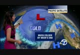
by week's end, so your thursday is looking wet and colder in the sierra nevada this will translate into snow. the national weather service already potioned a winter weather advisory. five to ten inches of snow expected 59,000, gusty -- at 5,000 feet. tomorrow afternoon, warm. on the peninsula, 77 in millbrae. mountain 80. 75 on the coast and pacifica. a warm day. daly city, sunset district, mid-70s, south city, downtown san francisco, 77. north bay, the fog is getting closer. 73 at bodega bay. east bay, temperatures close to today's levels. 79 in oakland. inland, you'll feel the warmth again. 80 concord. for the monterey bay, warm 76-degree day in monterey, could see records. the election day looking great. cooler wednesday. cold showers thursday, may see thunder and lightning and small hail. a few showers on friday, and then keying cold conditions expected the morning over the weekend with cool conditions during the day. temperatures will take a good 20-degree drop from tomorrow to friday and saturday. mike is here 4:30 to 7:00 with any changes. >> dan: coming up next, the famous cross
by week's end, so your thursday is looking wet and colder in the sierra nevada this will translate into snow. the national weather service already potioned a winter weather advisory. five to ten inches of snow expected 59,000, gusty -- at 5,000 feet. tomorrow afternoon, warm. on the peninsula, 77 in millbrae. mountain 80. 75 on the coast and pacifica. a warm day. daly city, sunset district, mid-70s, south city, downtown san francisco, 77. north bay, the fog is getting closer. 73 at bodega bay....
286
286
Nov 17, 2012
11/12
by
KGO
tv
eye 286
favorite 0
quote 1
in the sierra nevada, the snow levels are still high. this is a warm system. the highest elevations are starting to pick up snow. only chain controls right now state route 4. the rainfall totals the last 24 hours look like this. .38 in san francisco. look at santa rosa. over half an inch of rain. down toward san jose, .07 of an inch of rain. we are still counting. temperatures in the 50s and the 60s, and it is quite mild with the cloud cover. the waves of rain into saturday morning. a break develops tomorrow around midday. and a colder storm is coming in tomorrow night. your weekend is not a complete washout. of your plans may be okay. tomorrow morning scattered showers and temperatures in the 50s. could see an isolated thunderstorm. it is just a slight chance right now as this area of low pressure and the storm finally pushes through. we are still dealing with the leading edge of it. behind this system here is storm number two. it is a colder one coming in from the gulf of alaska. it gets here and it will make its presence known with the colder air. here is t
in the sierra nevada, the snow levels are still high. this is a warm system. the highest elevations are starting to pick up snow. only chain controls right now state route 4. the rainfall totals the last 24 hours look like this. .38 in san francisco. look at santa rosa. over half an inch of rain. down toward san jose, .07 of an inch of rain. we are still counting. temperatures in the 50s and the 60s, and it is quite mild with the cloud cover. the waves of rain into saturday morning. a break...
220
220
Nov 18, 2012
11/12
by
KGO
tv
eye 220
favorite 0
quote 0
they're picking up snow in the high country in the sierra nevada. the higher elevations. king's beach reporting just a light dusting of snow, truckee, still reporting rain. current temperatures there, 33 degrees. and blue canyon right now, some light rain as well. so, the snow levels are high now but will start to come down. santa rosa, over two inches from what we received this evening and last night. san francisco, close to an inch. oakland, over a half inch, and lesser amounts toward san jose. so it has been a nice rainmaker, overnight tonight. temperatures in the 50s and will remain in that zone overnight tonight. decreasing rain overnight. partial clearing by sunday afternoon, and looks like the showers will return as we head into late tuesday. you can see on our satellite radar composite just how quickly this ban moved through. these are clouds here and they could possibly still hold a few light showers. so, we'll say goodbye to the cold front and then we'll look for tomorrow morning, 5:00 a.m. a little bit of partial clearing but still possibly see a few stray show
they're picking up snow in the high country in the sierra nevada. the higher elevations. king's beach reporting just a light dusting of snow, truckee, still reporting rain. current temperatures there, 33 degrees. and blue canyon right now, some light rain as well. so, the snow levels are high now but will start to come down. santa rosa, over two inches from what we received this evening and last night. san francisco, close to an inch. oakland, over a half inch, and lesser amounts toward san...

 Live Music Archive
 Librivox Free Audio
 Metropolitan Museum
 Cleveland Museum of Art
 Internet Arcade
 Console Living Room
 Books to Borrow
 Open Library
 TV News
 Understanding 9/11